


Full Project (PDF):
Sponsor:

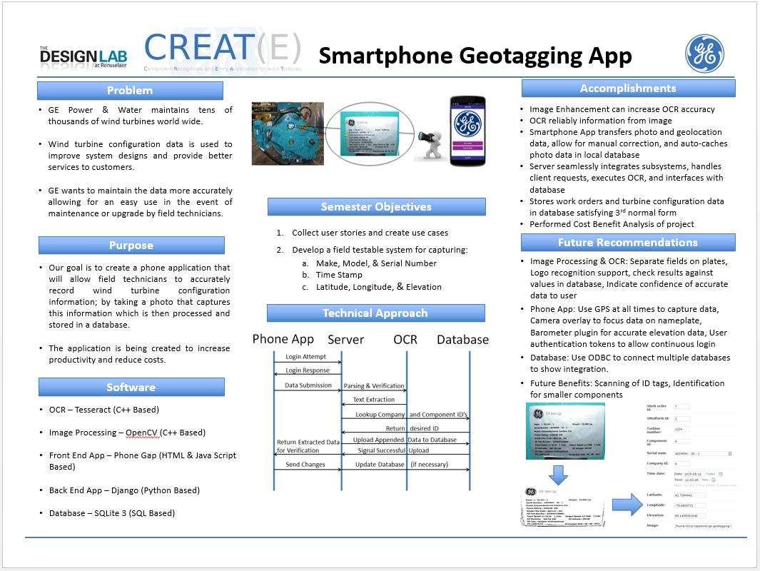
Purpose and Objective
- Create a phone application that will allow field technicians to accurately record wind turbine configuration information; by taking a photo that captures this information which is then processed and stored in a database.
- Increase productivity and reduce costs of field technicians.
Software
- OCR – Tesseract (C++ Based)
- Image Processing – OpenCV (C++ Based)
- Front End App – Phone Gap (HTML & Java Script Based)
- Back End App – Django (Python Based)
- Database – SQLite 3 (SQL Based)
Accomplishments
- Image Enhancement can increase OCR accuracy
- OCR reliably information from image
- Smartphone App transfers photo and geolocation data, allow for manual correction, and auto-caches photo data in local database
- Server seamlessly integrates subsystems, handles client requests, executes OCR, and interfaces with database
- Stores work orders and turbine configuration data in database satisfying 3rd normal form
- Performed Cost Benefit Analysis of project
Focus Area:
Product Development
Project Type:
Product Development
Project Engineer: